May 31: First day of dives-We arrived at Davis Rock around
9 am. The crew hooked us to the permanent mooring ball that is located at this
site. We got in & started the transects. This group uses fixed stations.
Years ago scientists drilled rebar stakes into the reef. There are 4 stations
at each site. Each station has 2 stakes. One is at the “offshore” end, and one
is at the “inshore” end. When divers are going to start working on a transect,
they swim to the offshore stake & put the end of a measuring tape to that
stake. They then swim toward the inshore stake, stretching the tape tight. Once
the measuring tape is stretched, the diver then goes back and places the
“chain.” This is a plastic chain that the diver carefully drapes over the reef
under the transect tape. Once the chain is placed, the diver puts a marker on
the chain to indicate 10 meters. Historically, researchers had identified and
measured corals on the entire transect. Over the last several years, the
researchers have found that they can get sufficient data by measuring corals
along only the first 10 meters of transect. In order to collect data on the transect, the
researchers swim along the transect looking for all corals growing within 0.5
meters of the chain on either side. Any corals that are found within the area
are measured. The researcher identifies the coral species, measures the width
& height of the colony & checks for mortality or disease.
+K+L+Kwang.jpg) |
| A picture I pulled from the internet to show the idea of a transect. |
Davis rock was my first time attempting this method. Before
the trip, I tried to study the species of hard corals that are common. However,
actually getting in the water and trying to remember species names, identify
them by sight, and remember the way that the corals group shortens their names,
was very different from reading the book. I was working a station in
conjunction with Rob (the boss). I was totally useless. I should have taken a
picture of the datasheet I tried to fill out. It was quite disheartening.

Once we came back up to the surface, I started talking to
other people about how to identify species. Most of the colonies in the
transect were Porites porites
(PPOR). There was also a few Porites astreoides (PAST), Montastraea cavernosa (MCAV), Siderastrea siderea (SSID), Meandrina meandrites (MMEA), Colpophylia natans (CNAT), Agaricia agaricites (AAGA), Eusmilia fastigiata (EFAS).
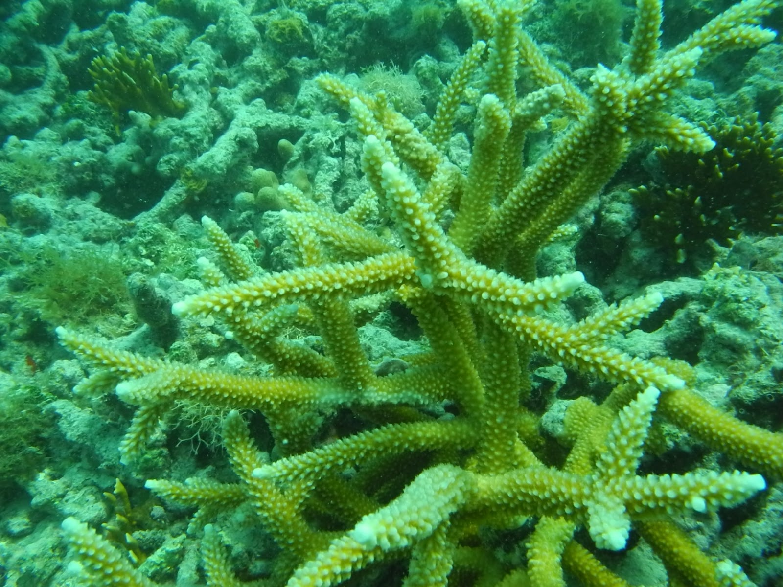 |
| Acropora cervicornis |
 |
| Diploria strigosa |
We then moved on to White Shoal for our second site of the
day. At this station I felt a little more on top of the corals. This site was a
little challenging because the survey only measures corals which are attached
to the bottom.
This was a site which was covered in rubble, so it was difficult
to tell which pieces were attached and which were not. This site also had most
of the same species, including PPOR, SSID,
MMEA, CNAT, EFAS, MCAV. Plus Acropora
cervicornis (ACER), Oculina diffusa
(ODIF).
 |
| Eusimilia fastigiata |
After we finished the survey, I started using my new camera to take pictures. It took some good pictures. Once we finished at White Shoal, we moved over to the dock at the fort. While other people went to walk around the fort, I went for a snorkel on the coal docks. There are often big tarpon that hang around that area with the other fish. However, this time, no dice. I did take a few nice pictures of other fish & corals. Still working on identifying the most common species. Had dinner at the dock and then got underway to anchor offshore.
 |
| Dock Pilings at Ft. Jefferson. Covered in corals |
 |
| Porites porites @ Ft. Jefferson |
No comments:
Post a Comment