Saturday, July 27, 2013

7/26/2013: Twenty-four Seven Operations


When working with such a large, capable, affable crew, it is easy to forget that someone is on watch 24 hours a day, every day, making the ship function. It is easy to forget when working in such a smooth environment that someone is working all of the time. The entire ship’s company cannot sit down for a meal together. Someone has to be driving the ship and making sure we are all safe.
 There are three NOAA Corps officers who stand watch in the bridge throughout the day. Each of their watches is 4 hours long & they happen twice a day, every day. During these watches, the officers steer the ship, watch for other vessels in the area, keep track of our location, and generally get us where we need to be. There is also a captain (or in this case, Chief Officer or C.O.), who doesn’t generally stand a watch, but oversees everything going on in the vessel, especially the ship’s interactions with the outside world, such as other vessels in the area. In addition to the officers, there is also a deckhand who stands a watch in the ship’s bridge during the night. During the day, the deck crew works on the back deck setting and hauling gear, etc. However, at night the ship is required to have extra eyes watching from the bridge as well.
During the night the officers rotate who is on watch. The deckhands also rotate who is awake. The engineers rotate who is awake as well, making sure that the engines, generators, water-makers, etc. continue to function. The science crew splits into a day shift and a night shift. I have described a lot of what the day shift does & mentioned what the night shift does. The day shift deals with the traps and the cameras. We get the bait into them, attach the cameras to the traps, get them in the water, retrieve them, and count, weigh, measure & dissect the fish that are captured. The night crew maintains the acoustic mapping equipment to provide maps of the bottom of the ocean so that we can set the traps in areas that are likely to hold reef fishes.
This ship is like a floating city. It really contains just about everything you would need to stay comfortable.  Every stateroom has a head (bathroom) with a shower. The ship makes fresh water from the salt water around us, so there is never a real shortage. There is a laundry room in the bow with three washers and three dryers in it. Plenty of power to run computers, negation equipment, lights, etc. Even satellite TV, internet, and phone service.  It’s pretty remarkable how much like normal life being at sea is. You just get too see some cool things if you look out your front door. Today we saw a leatherback turtle and several mahi mahi. Yesterday we saw a pod of spotted dolphins. You never know what you are going to see at any given moment, which makes it very interesting.

Friday, July 26, 2013

7/26/2013: Upwelling


Last night the ship mapped some areas closer to the edge of the continental shelf. They found a long ridge of rocks that looked promising for holding fish. During the day today we set traps at these locations. The videos taken from both ends of the traps had lots of rocks and areas which looked like they would have a lot of fish living in them. However, putting the CTD over the side, we found that the water temperature went from 26°C at the top of the water column to 16°C at the bottom in 55 meters of water. This steep decrease in water temperature is called a thermocline, and can easily be seen on a graph of water temperature.

Fish who don't want to eat
More fish not eating
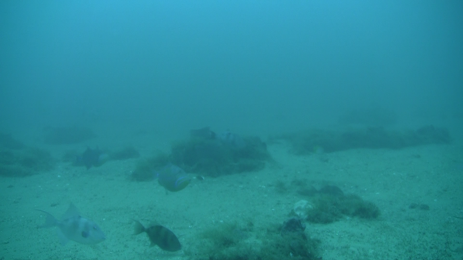
This cold water on the bottom of the ocean has two main effects on the fish we are hoping to video tape and catch in the traps. First, fish are exothermic (cold blooded), so their metabolism slows down when the water around them gets cold. This means that they don’t need to eat as much and are not attracted to the bait. They will be more inclined to sit outside the traps, not entering them if the water is cold.   Second, many of the species we are interested in capturing are not particularly cold-tolerant. They prefer to remain at temperatures above 20°C or so. They will often move out of a cold water area in search of warmer waters. When the bottom temperature gets too low, the whole neighborhood just empties out. We set our traps in areas which had both of these situations. Some of the video cameras observed fish that may often go into traps, but not were caught. 
Beautiful neighborhood. No one home.
Other cameras saw beautiful habitat, where we would expect to at least see fish, but none were present at all in the area.
Another abandoned subdivision
We think that the thermocline we are observing on the continental shelf in this area is due to upwelling.


Upwelling is a pretty common phenomenon along coasts where the prevailing winds are from land to ocean. The wind will blow the top layer of water away from the coast. A colder, more dense layer of water moves in to replace the water that was blown away.  The west coast f the U.S. has LOTS of upwelling. We don’t normally think of the U.S. east coast as having much upwelling. However, it has been known to occur in localized areas.

Thursday, July 25, 2013

7/25/2013: Ship's business


This was another pretty slow day of trapping. There just wasn’t a whole lot of habitat around for us to sample in this area, so we didn’t catch too many fish. A couple of items of note happened today, however. Every vessel at sea is required to conduct emergency drills once a week. Some ships make them a surprise for the crew. This ship lets everyone know that there will be a drill. However, the type & intensity of the drill varies. On a research vessel like this one, there is plenty of crew so that the science party’s job is to stay out of the way in the event of an emergency, so we were holed up in the ship’s lounge throughout today’s drills. However, the ship’s crew practiced for an oil leak on the vessel that turns into a fire. Everyone went to their assigned stations, broke into their teams and practiced what they would do in the event of a fire. They even got out the pumps that would help get water out of the boat if the ship lost power. 

After we had hauled in all of the traps, we started transiting to our next mapping location. It is about 50 miles Southeast of where we had been today, so the steam is several hours. On the way we passed by a weather buoy, so most of the ship’s company was out on deck with fishing lines in the water. Many types of pelagic fish like to gather around buoys, so everyone wanted to catch something big. Unfortunately, the only thing we caught were two barracudas. The teacher from Illinois was pretty excited about it. They were the first ocean fish he’d caught on hook-and-line.

CTD ready for deployment
XBT launch
In addition to capturing fish & taking their picture, we use two different devices to learn about the physical characteristics of the area, such as temperature, salinity, etc. The device we use during the day is called a CTD (stands for conductivity, temperature & depth meter). It is a complex electronics package which the ship lowers over the side while we are stationary. It sends back information to the ship about not only  conductivity (salinity), temperature, and depth, but also the amount of phytoplankton in the area, silt in the water column, and other parameters. These can be incorporated into the analyses of fish populations to account for changes in numbers. The second instrument used to sample the water is the XBT(expendable bathythermograph). This is a much less sophisticated & less costly piece of equipment. It gives a lot less data, only depth and temperature. However, the advantage of an XBT is that it the ship doesn't have to slow down in order to deploy it. XBTs are deployed a few times each night during mapping operations. Sound moves at slightly different speeds based on the temperature of the water, so the mapping crew has to know what the temperature of the water is so that they can get an accurate picture of the bottom. An XBT basically consists of a long piece of copper wire which is attached to the ship & thrown toward the bottom of the ocean. As it falls, it transmits the temperature of the water back to the ship. Once it reaches the bottom, the wire is broken. The first few days of the trip the mapping crew liked to play up how exciting "launching" an XBT was & got newbies super into it. It was a good joke to play on people, because it really is a very anti-climactic event. But it is cool to think we can find out the temperature of the water all the way to the bottom while we are moving at 9 knots & using nothing but a little piece of copper.

Wednesday, July 24, 2013

7/24/2013: Slow Day

Coney (C. fulva)
Bigeye (P. arenatus) & turtle
Rock Beauty (H. tricolor)
Queen trigger  (H. tricolor)
Last night while we mapped, we were still working in some pretty heavy current. We knew that this could pose a problem for setting traps. In the morning, we moved the the farthest inshore area that had been mapped in hope of avoiding the gulf stream. We set six traps. From the cameras, we found that 4 of them had moved across the bottom a significant distance. These four traps caught no fish. The two traps that had stayed in place each caught a few fish. One of the traps captured a species of fish I had never seen before, a coney (Cephelapholus fulva). Watching the videos, this site also held several neat Caribbean species I had never seen on videos before. These included rock beauty (Holacanthus tricolor) and queen triggerfish (Balistes vetula). These videos also produced some bigeye (Priacanthus arenatus) as well as a fleeting glimps of a sea turtle.

Since most of our traps were moving across the bottom and not much use to us, we started transiting to our next mapping area, 55 miles away. This gave the daytime science crew quite a bit of down time, which we filled in a few fun ways. However, of course, the folks who work on the boat didn't have this time to kick back. The officers on the bridge still had to drive the ship to our destination, watch for other vessel traffic & keep us all safe. The deck crew always has things to fix, maintain & paint. A steel hulled research ship needs a lot of painting and maintenance to stay looking nice. Many, many hours go into keeping her in tip-top shape. The engineers have to make sure that the generators are still functioning and everything is running smoothly. And of course, everyone still has to eat. So, while it was a pretty low-key, relaxing day for a few of us, most people had to work just as hard as always.


One thing I have learned from working on boats is to appreciate the downtime when it comes. You never know when you will get a bit of time off & it's best to make the most of it when it is there. You may be frustrated that you aren't working as much as you could be, but things could just as easily get overwhelming, so its best to take advantage of every minute of relaxing time available.


Tuesday, July 23, 2013

7/23/2013: Safety first


Last night’s weather was pretty rough. The wind monitor on the bridge was reading upwards of 35 knots and the seas were a solid 5 feet, with larger ones mixed in as well. When we got up this morning the seas were 5-7 feet and the wind was still blowing at least 25 knots. These are conditions that the boat handles quite well.  This vessel is much more stable than many I have worked on before, deceptively so. The back deck is almost 8 feet off of the water, so when the seas are 7 feet high, they are barely coming up to where you are standing. However, retrieving gear is not easy under these conditions.  We delayed putting traps in the water until almost 10 am. This gave time for the sun to come up higher & provide more light to the cameras on the bottom. The combination of traps and cameras give us 3 different types of information.
1.       Traps bring fish to the boat. We can then select the fish we are most interested in studying & keep those for further study.
2.       Cameras give us information about the species which are more trap-wary.
3.       Cameras also give us “groundtruth” information about the types of habitat that are present in the area.
When the chevron traps are sitting still, they work for all three of these purposes. However, if the current or wind is too strong, or the seas are too rough, the traps will move along the bottom. When traps are moving they don’t catch fish. They also cannot be used to reliably index the number of species seen on the videos.  Therefore, they can only be used to show what the habitat in the area looks like.
We deployed our first set of chevron traps at 10 & started hauling them back around 11:30. Once we started looking at the video, we knew that the traps were moving too much to be counted as samples and would ultimately be disregarded as data. The haul back was slightly dicey as well, with the boat blowing over one of the traps. Since the traps were of minimal use in these conditions and our next site for mapping was a few hours’ steam away, Zeb decided to not set any more traps. As the day has worn on, the weather has improved significantly, with seas down to 3 feet or less and winds dying down to less than 20 knots. The weather is forecast to continue improving for the next few days, so we should be able to set plenty of traps in the coming week.